


Area 7: Prosperous people


Sustainable development is built on three pillars that interact closely with each other: ecological, economic and social sustainabilities. To evaluate the degree of prosperity of an island community, social sustainability is the focus. It is about systems, structures, and relationships, both formal and informal, and creating healthy and viable communities. The well-being of the island and the islanders has to be supported in well-functioning infrastructures for social and cultural life, allowing open and inclusive citizen engagement.
A socially sustainable society has the human need in focus, both on an individual level and as a part of society. For a resilient community, population growth and the demographic distribution have to give hope for future development. Democratic processes, a good integration of newcomers and a welcoming and rich cultural life are all premises and results of a well-functioning society. These actions, handled with care, will usually enhance the aspects of health and security.
Indicators in the Prosperous people area:
- (39) Age distribution
- (40) Good health
- (41) Safety
- (42) Integration
- (43) Voter turnout
- (44) Island culture
- (45) Population growth
Indicator 39: Age distribution
a Rationale
The share of the working-age population in Europe is expected to decline during the period 2020-2100. Accordingly, older people will account for an increasing share of the total population. People aged 65 years or over will account for over 30% of the population in the EU by 2100, compared with 21% in 2020.
Whether the number of residents is growing or shrinking is an indicator of the habitability of an island. It is also important to understand if the population grows thanks to immigration or the “local production” of new islanders.
In this indicator, there are three demographic groups to be considered: (1) children and young people in need of daycare and school, (2) grownups of working age, and (3) older persons outside working life who will eventually need some extra care. Unless there is a noticeable unbalance, gender is not an indicator of habitability.
Islands tend to over-represent older people who settle on islands when retired.
b Definition
The age distribution of the resident population on the island, measured by the total age dependency ratio.
c Computation
The age dependency ratio expresses the relationship between three age groups within a population: ages 0-15, 16-64 and 65-plus. Higher values indicate a greater level of age-related dependency in the population. The “dependent population” is defined as people ages 0-15 and 65-plus, while the “working-age population” is between 16 and 64.
| Children and young people, age 0–15 | % |
| Grownups, age 16–64 | % |
| Older people, age 65– | % |
The total age dependency ratio is calculated as:
([Population ages 0–15 + Population ages 65-plus] / [Population ages 16–64]) × 100
| 1 | 2 | 3 | 4 |
| A dependency ratio of >70 | A dependency ratio of 60–70 | A dependency ratio of 50–60 | A dependency ratio of <50 |
d Example

The Outer Hebrides are situated 55 km (34 miles) off the northwest coast of Scotland, and they cover an area of 3000 square kilometres. They consist of over 100 islands, 15 of which are populated. The major islands are Lewis, Harris, North Uist, Benbecula, South Uist and Barra. The area is sparsely populated, with a density of nine people per square kilometre, compared to a Scottish average of 65.
The only large town is Stornoway (Steòrnabhagh) on Lewis. It is the Outer Hebrides’ largest town and administrative centre. There are approximately 6,953 people in the Stornoway settlement Laxdale, Sandwick and Newmarket. The remaining population is scattered throughout over 280 townships across the islands.
The most recent mid-year population estimates for the Outer Hebrides give a population of 26,500. This number has been relatively steady in recent years, but there has been a long term population decline. Since 1991, the population in the region has declined by 10%. The recent decline has largely resulted from a “natural” population decrease, more deaths than births. From mid-2019 to mid-2020, there was a decrease of 0.8% (220 persons).
Demographically, the population of the Outer Hebrides is ageing. The continuing trend is for young adults to leave the islands for further education or employment. The median age in the islands was estimated to be 49.9 years (Scottish average 42.1 yrs) in June 2020. A higher percentage of the population is of ‘pensionable age’ (Outer Hebrides 25%, Scotland 19%), and a lower percentage is of ‘working age’ (Outer Hebrides 59%, Scotland 64%).
The age profile for the area is:
| 0–15 years | 16% |
| 16–64 years | 59% |
| 65– years | 25% |
The total age dependency ratio is calculated as:
([Population ages 0–15 + Population ages 65-plus] / [Population ages 16–64]) × 100
16 + 25 / 59 = 0,69
0,69 × 100 = 69
The indicator value for the Outer Hebrides is 2.
References
- Comhairle nan Eilean Siar. 2022. Outer Hebrides Factfile.
- Eurostat. 2022. Population structure and ageing.
- ANON. 2011. Island Sustainable Energy Action Plan. Outer Hebrides.
Indicator 40: Good health
a Rationale
Island communities top the list of places in the world where people enjoy longer and more meaningful lives, such as Ikaria in Greece, Okinawa in Japan, and Sardinia in Italy. These islands belong to “The Blue Zones” of the world, a phrase coined by the Belgian demographer Michel Poulain and the Italian statistician Gianni Pes. The concept has since then been explored by many, among them the American adventurer David Buettner who wrote a series of articles on blue zones for National Geographic magazine. Buettner states: “Our life spans are about 20% dictated by our genes, the rest is lifestyle”.
Most national institutes of Health and Welfare provide disease indexes that evaluate the health of municipal residents, typically based on the most common and serious diseases (cancer, coronary heart disease, diseases of the blood vessels of the brain, diseases of the musculoskeletal system, mental illness, accidents, and dementia). The lower the value of such an indicator, the healthier the population.
b Definition
The health of the islanders according to national health indexes, compared to the rest of the nation. Or surveyed self-rated health for islands that are not municipalities.
c Computation
Most European countries use a health index describing the population’s health in different municipalities and regions in proportion to the whole country. The comparative number of the country as a whole is 100. The lower the number for a city, municipality or province, the healthier the population.
If your island is a municipality, you should be able to find national data on the health status of your island. There are, however, varying approaches in different countries, which means that this indicator might have to be applied to the statistical data that can be found in your country. If the rating below is not applicable in your country, try to find a corresponding system!
| 1 | 2 | 3 | 4 |
| The health index is over 115 | The health index is 100–115 | The health index is 85–100 | The health index is below 85 |
For islands representing smaller entities than municipalities – which most of our islands are – this data can be hard to obtain. If experts on health matters (nurses, medical doctors, statisticians) can confirm that the island’s health status corresponds to that of the municipality, use that index.
If not, we recommend that a question on self-rated health be included in any surveys done among the islanders. This seemingly simple question: ‘In general, how would you say your health is?’ (Ware & Sherbourne, 1992) is widely used by researchers and has been found to correspond well with health surveys done on a much broader scale. Responses are on a five-point scale (excellent, very good, good, fair or poor). Since the Habitability Index is a four-point scale, “excellent” and “very good” both result in a 4:
| 1 | 2 | 3 | 4 |
| Poor | Fair | Good | Excellent or very good |
d Example

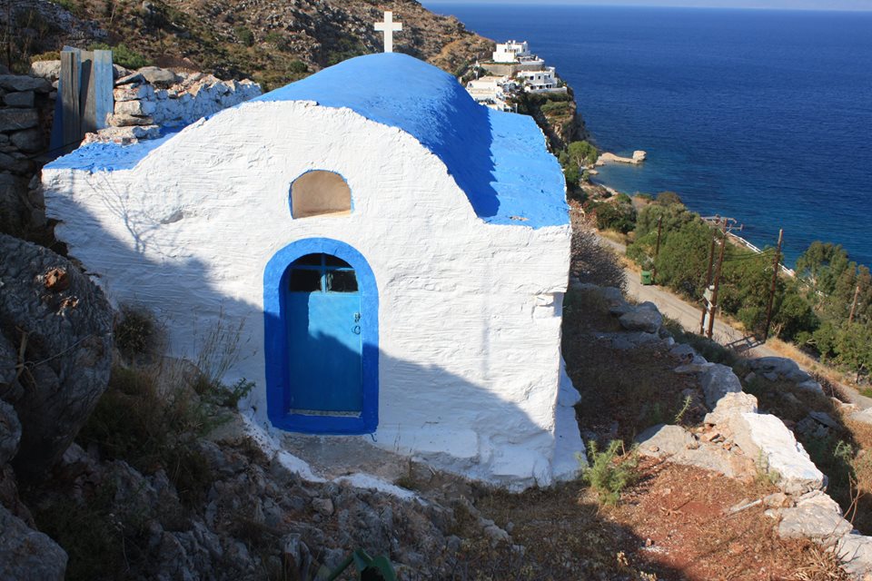
Ikaria is a Greek island in the Aegean Sea with an area of 255 km2 and some 8,300 all-year inhabitants. Ikaria lacks a good harbour, ferry transports are irregular, and the short landing strip is very windy. The average income is very low, and the unemployment rate is very high. The island has a dark history; the Ikariótes (Icarians) have suffered hard times. Ikaria is both famous and infamous, nicknamed the “Red Island” – till 1973 and the fall of the Greek Military Regime, Ikaria was used as an exiled land for political prisoners and mostly communists.
In spite of this – or because of this? – it has become one of the world’s five “Blue Zones”, i.e. a demographically confirmed geographical area where people live measurably longer. One in three make it to their 90’s on Ikaria. Why is this?
The Ikarian diet and lifestyle have become famous for their health benefits. According to Christina Chryshoou, a researcher at the University of Athens, almost the entire Ikarian population is free of chronic disease and dementia, with sexual activity until their late 80s. A daily routine that includes taking naps, drinking herbal teas, gathering with friends and family, exercising by walking and tending to gardens have all influenced this.
People in Ikaria live in mountain villages that necessitate activity every day. They also have a diet that is very high in olive oil, fruits and vegetables. About 150 kinds of vegetables grow wild on the island. These greens have somewhere around ten times the level of antioxidants in red wine.
The value for Ikaria is 4.
References
- Buettner, D. 2010. The Blue Zones: Lessons for Living Longer From the People Who’ve Lived the Longest.
- Buettner, D. 2012. The island where people forget to die. The New York Times Magazine.
- Idler, EL & Benyamini Y. 1997. Self-rated health and mortality: a review of twenty-seven community studies. J Health Soc Behav 1997;38(1):21–37.
- Koskinen, S & Koskela, T. 2019. Sjuklighetsindex: Skärpta skillnader i sjuklighet mellan kommunerna. Institutet för hälsa och välfärd.
- Miilunpalo, S, Vuori, I, Oja, P, Pasanen, M & Urponen, H. 1997. Self-rated health status as a health measure: the predictive value of self-reported health status on the use of physician services and on mortality in the working-age population. J Clin Epidemiol 1997;50(5):517–28.
- Ware Jr, JE & Sherbourne, CD. 1992. The MOS 36-item short-form health survey (SF-36). In: Conceptual framework and item selection. Medical Care 30, 473–483.
Indicator 41: Safety
a Rationale
If you have food on your table and a roof over your head, you are less likely to commit a crime. “A hungry man is an angry man”, is an ancient proverb. All human beings have basic needs, including food and shelter. Community, education, and economic opportunity follow soon after.
Safety is the state of being secure and protected from harm and danger. A safe place needs to provide freedom from crime, a peaceful environment, and quality health outcomes. It also requires an economy that allows governments to support their people and individuals to earn enough wealth to fulfil their basic needs.
Can islands provide low crime rates, no ongoing conflict or militarisation, good healthcare and health outcomes, economic prosperity and negligible environmental threats?
Ranking low on one aspect of safety affects the totality. Small island Zmiinyi (Snake Island) in the Black Sea is only 17 ha with a population ranging from 30 to 10 (depending on whom you ask). On February 24 2022, supported by the Russian cruiser Moscow, it was attacked and invaded. Crime, healthcare and money suddenly lost importance as war hit the island.
Security is not so easy, to sum up.
b Definition
The assessed sum of crime rates, conflict, healthcare, health outcomes, economic prosperity and environmental threats; and the ability to call for help if needed, which is not always a given fact on some remote islands.
c Computation
| Aspect | Sources | 1 | 2 | 3 | 4 |
| Crime rates | National statistics, and the Current Crime Index | ||||
| Ongoing conflict and militarisation | Global peace index | ||||
| Healthcare | See indicator 36 | ||||
| Health outcomes | See indicator 40 | ||||
| Economic prosperity | See indicator 26, 28 and 29 | ||||
| Freedom from environmental threats | See indicator 13 and 14 | ||||
| Mobile coverage | National mobile operators |
d Example

Gozo, or Ghawdex in Maltese, is the island where Ulysses spent time with Calypso three thousand years ago. Gozo has an area of 67 km3 and 31,000 all-year residents. Regular ferry services to Gozo began in the year 1241. For over 650 years, ferries went to and from Valetta, but nowadays, they run between the two new ferry terminals Cirkewwa in the northwest of Malta and Mgarr on Gozo. It takes 23 minutes by boat from the urban, hectic Malta five kilometres away.
Tourism is the main source of income in Gozo. Diving is a major attraction thanks to world‐acclaimed diving sites, amplified by scuttled vessels creating interesting diving attractions and infrastructure serving the diving industry. In 2017, Gozo had 388,000 visitors, and whereof many were domestic day-trippers, but also 29,700 scuba-divers who spent 282,600 nights on the island. The whole contribution of the tourism industry in terms of expenditure amounted to around €180 million in 2017, which is equivalent to just under 50% of the Gozo GDP. International visitors stay for longer periods of time, spending more than day-trippers or domestic tourists.
Gozo is a fairly safe place to visit: street crimes, burglaries, and petty thefts are not major concerns. In 2020, there were 276 reports of theft. No underage people were caught in entertainment establishments; ten people were caught smoking in public places. Gozo Police has 30 fewer officers than required to have a full complement, but that does not seem to be a problem. A real estate agent states that the crime rate on Gozo has always been nearly non-existent “since we are an island where everyone knows everybody. Landlords leave the key in their front door when they go out.” His view is well supported by statistics from Cambeo (an offspring of Google that produces safety reports from towns and places all around the globe).
More than half of the residents believe that a tunnel or a bridge between Gozo and Malta would improve life on the island, where the biggest problem is the lack of work. Malta, including Gozo, is not dependent on Russian gas but sources most of its wheat, barley and corn from Ukraine. In 2019, Malta rescued over 3,000 refugees at sea; in 2020, 2,300; and in 2021, 800. Being sheltered by Malta to the south, Gozo only receives a minor part of the refugees but seems to take fairly well care of them.
The computation for Gozo would be
Crime rates: 4
Ongoing conflict and militarisation: 3
Healthcare: 4
Health outcomes: 4
Economic prosperity: 3
Freedom from environmental threats: 3
4 + 3 + 4 + 4 + 3 + 3 = 21/6 sums up to 3.5.
The indicator value for Gozo is 4. There is nothing to overturn the computation, resulting in a fair grade for this peaceful, sleepy, not as heavily populated place as “mainland” Malta and therefore greener and much more secure.
References
- Current Crime Index. Numbeo.
- Global Peace Index. 2021. Vision og Humanity.
- Crime in Gozo, Malta. Numbeo.
Indicator 42: Integration
a Rationale
In an ideal island society, no one suffers from loneliness, and there are plenty of social connections. Small islands offer good conditions for togetherness and participation.
Activities of different associations and corresponding groupings provide a context for social interaction. As a newcomer, it is not always easy to enter a society, but active support and help can facilitate integration.
b Definition
Number of active compounds. Number of organised events and social events open to the public. Measures to include newcomers and alleviate loneliness and exclusion.
c Computation
| 1 | 2 | 3 | 4 | ||
| a | Associations taking an active part in integration (not necessarily formal) | None | 1-2 | 3-4 | 5 or more |
| b | Open events and/or information channels | None | 1-2 | 3-4 | 5 or more |
| c | Active inclusion of newcomers | None | Measures and plans in this direction are taken | There is a person appointed for this task | There are several groups, persons or an organisation appointed for this task |
| d | Active prevention of loneliness and exclusion | None | Measures and plans in this direction are taken | There is a person appointed for this task | There are several groups, persons or an organisation appointed for this task |
| Sum of obtained values, divided by 4: (a+b+c+d)/4 | |||||
d Example
In 1961, the population of the Greek island Tilos was 789 people. In 1981 it was 301; by 1991 it had decreased to 258 due to emigration to the USA and Australia. Today, Tilos has 780 residents again.
Its former mayor, Anastasios Aliferis, was the island’s doctor and an unusual bird lover. He mobilised over 6,000 ornithologists and the majority of the islanders in an appeal to make Tilos a natural reserve for birds that were formerly hunted. Of course, bird watchers came in thousands to Tilos.
The Greek island of Tilos has a strong tradition of integration. As the mayor of Tilos, Anastasios Aliferis wed two homosexual couples in 2008. As this is not allowed in Greece, he was threatened with imprisonment. The case was eventually dropped, but people who wanted to get married came to Tilos.
After Tasos passed away in 2012, his daughter-in-law Maria Kamma was elected Mayor. In 2015, refugees from the Middle East started entering Europe, the vast majority by crossing the Aegean Sea from Turkey to Greek islands less than 6 km from the Turkish coast, such as Chios, Kos, Lesbos, Leros, Kastellorizo, Agathonisi, Famrakosini, Rhodes, Tilos, and Symi. At times, incoming refugees on some of these islands outnumbered the locals.
On Tilos, refugees were not only given only accommodation and residency; they were also given work and were integrated into the society. Most migrants in Greece live in camps, while Tilos has integrated 50 migrants. Maria Kamma may have turned her community into Europe’s friendliest island, saying: ”If this small island managed to do this, then it is a bright example that with a little bit of effort there will be no refugee crisis, no humanitarian crisis, there will be no refugee problem, not only in Greece but in all of Europe, too.”
In 2019, Maria Kamma was re-elected as Mayor of Tilos.
It seems Tilos lands on 5 + 5 + 5 + 5 = 20 / 4 = 5. And, it is most certainly worth it.
References
- Apostolou, P. 2017. The eco-friendly tiny Greek island that welcomes Syrian refugees. SBS Greek radio.
- Hellenic Statistical Authority. 2011. Population-Housing Census.
- Twombly, R. 2018. Europe’s friendliest island? ESIN blog.
Indicator 43: Voter turnout
a Rationale
Voter turnout is an indicator of trust in society and the political system in which it exists. Differences in voter turnout between nations tend to be greater than those between classes, ethnic groups, or regions within nations. Contradictorily, some of the factors that cause internal differences do not seem to apply globally. For instance, nations with better-educated populations do not have higher turnouts.
In the 2019 elections to the European Parliament, 51% of eligible voters participated. Of young people under 25 years of age, only 42% voted. Of those aged 25-39, only 47%.
An island is always in the lead in national elections: an example is Malta, with 90% voter turnout. Surveying recent elections in regions and countries with many islands in the 2020-2021 period, Malta is followed by Ireland (62.9%), Madeira (55.1%), Azores (45.4%) and Croatia (46.4%).
Interest in expressing one’s opinion in democratic elections measures citizens’ belief in the island society around them.
b Definition
The percentage of eligible voters who cast a ballot in an election.
c Computation
| 1 | 2 | 3 | 4 |
| Less than 50 | 50-59.9 | 60-69.9 | Over 70 |
d Example
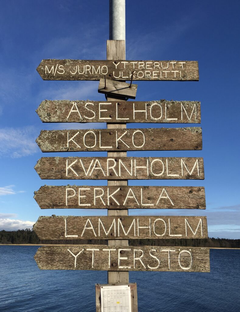
Voter turnout of the June 2021 municipal elections in five former municipalities (polling districts) in the southwestern archipelago of Finland, which now form the municipality of Pargas.
| Polling district | Entitled to vote | Turnout | Value |
| Iniö | 166 | 77.1 | 4 |
| Houtskär | 444 | 72.1 | 4 |
| Korpo | 693 | 69.4 | 3 |
| Nagu | 1,179 | 64.7 | 3 |
| Pargas | 9,832 | 57.4 | 2 |
It seems the smaller the place, the more commitment. Both Iniö and Houtskär would get an indicator value of 4.
Indicator 44: Island culture
a Rationale
When analysing the habitability aspect of your island culture, don’t compare it with Leonard Cohen’s Hydra or the island of Eigg in Scotland. Your main competitor is the societies on the coast, not other islands. The idea is to assess how well you take care of what’s yours for the benefit of those who live there, those you want to attract, and visitors. Local culture is often used to entertain tourists. Be careful not to wear it down.
We look at seven aspects of local culture: the treasures of your island, either natural or cultural; the local museums displaying your cultural assets; if there is available information in printed form or on the web; if there are local guides and local paths; and if you are arranging cultural festivals.
b Definition
How well the islanders are taking care of the island’s own local culture.
c Computation
| Aspect | 1 | 2 | 3 | 4 |
| Natural, cultural and historical treasures | Many treasures have been destroyed or are at risk | Mischiefs and environmental destruction occurs | Relatively well kept | Very well kept |
| Local museum(s) displaying your history, art, handicraft, nature | No local museum | One fairly good museum | A local museum that displays the island’s culture very well | Several well organised museums |
| Available information about the island’s nature, culture, songs, language and history in books and films | Information is missing | Many areas are missing important information | Good information in most areas | Lots of information in all areas |
| Available information about the island’s nature, culture and history on the internet | Information is missing | Many areas are missing important information | Good information in most areas | Lots of information in all areas |
| Local guides | No local guide | There is a local guide but only for some areas | There are local guides, some very good (certified?), for most areas | There are very good (certified?) guides in all areas |
| Walking paths | No walking paths | There is a walking path but not very well managed | There are several walking paths some with signs and maps | There are several walking paths with signs, printed and digital maps |
| Festivals | No festival | There is a yearly festival | There are several yearly festivals | There are several festivals attracting people from far away |
d Example

Kihnu is an Estonian island in the Gulf of Riga with an area of 16.8 km2. It has been one of the remaining small municipalities of Estonia since the 2017 administrative reform when municipalities with populations under 5,000 merged. The other small communities are small islands, too: Vormsi, Muhu and Ruhnu. It was wiser and smarter to keep them self-governed.
On Kihnu, men have historically been absent to fish and hunt seals, being away for months. The role of women expanded beyond traditional gender roles and into every aspect of life on land. They took care of the farm, tending chickens and sheep, making clothes and fixing tractors. Often referred to as Europe’s last matriarchy, the island community is primarily powered by the strength and resilience of women. Keepers of a culture so rich it became a UNESCO World Heritage in 2003.
Nowadays, the men still work away from Kihnu for weeks, mainly with construction. The women balance the responsibilities of farming, child-rearing and daily life with the inherited duty of maintaining ancestral traditions. They drive old Russian army motorcycles with side-vans, dressed in headscarves and striped red skirts, take care of the lighthouse, lead church services and even dress up as Santa at Christmas.
The population of Kihnu is officially 700 people, whereof 400 actually live here all year round. They welcome 30-35,000 tourists per year. A trip to the island takes 3 hours from Pärnu and 1 hour from Manilaid. When the sea is frozen in winter, it is possible to drive to the island over the ice. There are only a few paved roads, two small food shops, a museum, a church, and a primary school with 36 children, down from over 100 children some years ago.
The local museum is superb, thematically well displayed, airy and well managed. The young Mayor (a man) is not dressed in a business suit but in a traditional sweater. The guides are excellent, teaming up and working well together.
It is easy to fall in love with the island and to understand its preconditions and why it became what it is. They are proud of what is theirs and score high in taking care of their culture:
Natural, cultural and historical treasures: 4
Local museum(s): 4
Available information in books and films: 4
Available information on the internet: 4
Local guides: 4
Walking paths: 4
Festivals: 4
4 + 4 + 4 + 4 + 4 + 4 + 4 = 28 / 4. The amazing result of Kihnu leads to an undisputable 4.
Indicator 45: Population growth
a Rationale
In Northern and Western Europe, small islands have small populations and declining populations, while in Southern Europe, small islands have large populations, and numbers are quite stable. Growth is thus mainly an issue for islands in the Baltic Sea and the Atlantic Ocean. A population can grow by children born on the island or by immigration.
This is the 45th and last indicator of the habitability analysis. It is built upon the other 44 indicators, an entire syndrome of associated actions and events that lead to population growth, which we evaluate with the help of a brutal four-grade scale. The clearest indication of successful development of the attractivity of a society is a constantly rising island population.
b Definition
Population change in percentage of the resident population.
c Computation
| 1 | 2 | 3 | 4 |
| Population change over the last ten years is negative | Population is stable | Population change over the last ten years has been up to 5% | Population change over the last ten years has been more than 5% |
d Example
One of the 15 inhabited islands of the region of Bretagne is Ouessant, a rocky landmass some eight by 3 kilometres. The dangerous waters around Ouessant are amongst the most troublesome in the world, with a 10-knot tidal stream and numerous sharp reefs both over and under the water surface.
The official population number of Ouessant is 834 (2016), but it is really 805 (2021), having been reduced by half since 1968. In summer, the population is at least 2,000, and the number of second homes is now reaching 500. There are about 150,000 one-day visitors per year to the island. In the summertime, they can be over 1,000 a day.
The Mayor of Ouessant, Denis Palluel, a teacher by profession, founded the inter-island organisation “Les îles du Ponant” (AIP) in 1971. They initiated measures to maintain the population of these islands and started to cooperate with the University of Brest (UBO) and professor Louis Brigand. An island project brand was developed within a network of companies, supported by a research program. A yearly island festival has been organised to make discussion and engagement possible and as an affirmation of the French island identity. Eventually, the university initiated interdisciplinary and interinstitutional research on island issues, focusing on three of the islands (Ouessant, Molène and Sein), including offices, labs and lodging on the islands.
In 2016, a formal contract was set up between AIP and UBO, leading to a feasibility study in 2017, a partnership with the regional authority of Brétagne and the development of support and structures for residents, local authorities and researchers. A master’s program and a summer university, both based on the islands, were developed.
This turned out to be the most comprehensive support program for maintaining habitable islands in Europe. As a gift from above, the first baby was born in 2017 on the island of Ouessant for a good thirty years. The baby, Léanie, decided to enter the world while her mother was waiting for the ferry. Firefighters and the island doctor were called for, and the future mother was placed in the fire truck and taken to the airfield where the baby was born while waiting for the arrival of the mainland medical services.
“Les Ouessantines are like that; they never want to leave!” commented a resident in national media. “She hadn’t time to go as she had to take care of her job at the local supermarket.”
Sad to say, the score for Ouessant is 1. But, Léanie gives us hope.

The Habitability Handbook – An assessment tool for viable island communities by the Archipelago Institute at Åbo Akademi University is licensed under Creative Commons Attribution-NonCommercial-NoDerivatives 4.0 International License.